
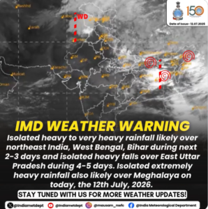
IMD forecasts widespread monsoon activity over eastern and northeastern states, with extremely heavy rainfall expected in Meghalaya on July 12.
India Meteorological Department (IMD) has issued a fresh IMD weather warning, forecasting heavy to very heavy rainfall across several parts of eastern and northeastern India over the coming days. The department has advised residents in the affected regions to remain cautious and stay updated with official weather forecasts.
According to the latest forecast, heavy to very heavy rainfall is likely over Northeast India, West Bengal and Bihar during the next two to three days, while East Uttar Pradesh is expected to receive isolated heavy rainfall over the next four to five days.
Meghalaya likely to witness extremely heavy rainfall today
Among the affected states, Meghalaya is expected to experience extremely heavy rainfall on July 12, 2026. Such intense rainfall may lead to waterlogging, localized flooding, landslides in vulnerable hilly areas, and disruptions to transport services.
Authorities have urged residents in vulnerable locations to remain alert and avoid unnecessary travel during periods of intense rainfall.
Areas under IMD rainfall alert
The latest IMD forecast highlights:
- Heavy to very heavy rainfall: Northeast India, West Bengal and Bihar for the next 2–3 days.
- Isolated heavy rainfall: East Uttar Pradesh during the next 4–5 days.
- Extremely heavy rainfall: Meghalaya on July 12, 2026.
The active monsoon conditions are expected to continue influencing weather across eastern and northeastern parts of the country.
Advisory for residents
The IMD has advised people living in the affected regions to:
- Follow official weather updates regularly.
- Comply with advisories issued by local authorities.
- Avoid unnecessary travel during periods of intense rainfall.
- Stay away from flooded roads, rivers and landslide-prone areas.
Emergency response agencies are expected to remain on alert in districts that may witness intense rainfall over the coming days.
How weather alerts help residents prepare
Weather warnings are intended to help people understand the possible impact of an approaching weather system and make timely decisions. The colour-coded alert system used by the IMD provides a broad indication of the level of caution required as weather conditions develop.
An Orange Alert generally signals a situation where people and authorities should remain prepared for potentially disruptive weather. The practical impact, however, can differ from one locality to another. Rainfall may be intense in one area while another nearby location receives a less severe spell.
For residents, local forecasts are therefore more useful than relying only on the alert colour. People planning journeys can check rainfall updates, road conditions and local advisories before leaving home. During thunderstorms, staying indoors and avoiding exposed locations can reduce risks associated with lightning and strong winds.
Why monsoon rain can vary sharply between cities
Monsoon rainfall is not uniform across India. Even when a broad weather system is influencing several regions, the amount and intensity of rain can differ considerably between locations.
Local geography plays a role in this variation. Coastal areas, mountain regions and inland plains respond differently to moisture-laden winds and changing atmospheric conditions. The movement and strength of monsoon systems can also determine whether a location receives prolonged rainfall or shorter, intense spells.
Urban areas can face additional difficulties during heavy showers because dense construction and paved surfaces limit the natural absorption of rainwater. Drainage capacity, local topography and the condition of water channels can influence how quickly accumulated water clears.
This is why a reduction in rainfall intensity does not necessarily mean that all weather-related disruptions disappear immediately. Waterlogging and traffic problems can continue in some areas even after the heaviest rain has passed.
For people following weather today updates, the most useful approach is to combine the broader IMD forecast with local advisories and real-time conditions before making travel or outdoor plans.
FAQs
Which states are under the latest IMD weather warning?
Heavy to very heavy rainfall is forecast for Northeast India, West Bengal and Bihar, while East Uttar Pradesh is likely to receive isolated heavy rainfall.
Which state is expected to receive extremely heavy rainfall today?
According to IMD, Meghalaya is likely to receive extremely heavy rainfall on July 12, 2026.
How long will the heavy rainfall continue?
Heavy to very heavy rainfall is expected for the next 2–3 days in Northeast India, Bihar and West Bengal, while East Uttar Pradesh may witness isolated heavy rainfall for 4–5 days.

